This article will continue to be modified as MAPS 3 developments occur and more information becomes available. It was originally posted on September 20, three days after Mayor Cornett’s September 17 announcement of MAPS 3, and it was last modified on October 5, 2009. However, I’m calling this revised article, MAPS III — The Actual Proposal Redux because it more accurately reflects my personal opinions today as opposed to those when it was first written on September 20 and then completed on September 24. For purposes of historical completeness, a copy of the version which was current as of September 24 is available here.
In another lengthy article, I tried as well as I was objectively able to present the pros and cons with regard to the on-the-table report of the Core To Shore Steering Committee to contribute to the discussion, and I’ll not repeat the content of that article here. In a nutshell, that article presented the Steering Committee’s late 2007 report for the purpose of understanding, discernment, and discussion at a time that, presumably, your and my input may have been a factor in shaping the final plan. In a separate article, ballot, ordinance, and council resolution issues are addressed.
MY EARLIER RANT. In the earlier version of this article, I began it with a preface in which I voiced a pair of complaints. Among other things, I said:
As a preface to a pair of procedural matters which I regard as important and have been handled poorly, let me begin by saying that I have respect and a good regard for our mayor and the city council members that I personally know. Despite that, I have a present need to be straightforward.
Additional Resources Park Pics Other Pics
In my own rambling way, those complaints were identified more particularly:
- Misleading Statements About Value of Additional Input. Among other things, I said these things about that:
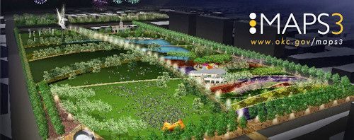
I really do hate being the village jackass by saying this, but it is now evident that statements by the mayor during the spring that input could still be made and would be considered in shaping the final MAPS 3 proposal are now clearly nothing but window-dressing. Do I correctly recall something being said about town hall meetings? Heck, now we know that the City Park renderings at the end of this article are dated August 14, 2009. It seems clear enough that those of us who took the mayor’s comments to heart and spent considerable time and thought in discussing this stuff during the summer were just flat-out wasting our valuable time.
I also said,
I’m not presently inclined to think that your and my input during summer 2009 mattered at all — I’m more inclined to think that the summer’s MAPS III decisions were based solely on political considerations which would facilitate a MAPS III passage at the polls. The mayor essentially said as much in the press conference when he said that the city was probably divided into 3 thirds: (1) Those wanting everything downtown; (2) those wanting everything spread out through the city; and (3) those wanting to chose the best ideas no matter where such project may be located. He pointed out that proposals like this are always difficult to pass. He implied that the package’s blend endeavored to have stuff to interest all three groups to facilitate passage of the package deal.
That’s fair enough — political savvy in passing MAPS I was certainly involved and required and good political judgment in a package deal like this is certainly a good thing.
Political savvy is one thing but misleading citizens to believe that the summer’s additional input was still welcome and would be considered is something else altogether — and what happened to those town hall meetings that were promised in the spring? Never happened. Secondly, the absence of detail presented on and after September 17 (thus far) is also quite another matter. Political savvy is good, but the items just mentioned show a lack of respect for the citizenry.
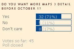
- Lack of Detail. The second major gripe I made was that we hadn’t been given the full deck of cards, right then, when they were available to be given. A few days later, I started a short-term poll ending 9/30/09, results shown at right. All we were (and have thus far been) given is a summary. About my perceptions and expectations, I complained that we were entitled to all available detail as soon as it was available, that we were smart enough to cuddle up to it and analyze it for ourselves, right then, and not wait for MAPS 3 campaign presentations beginning this month in which that detail would strategically (I didn’t use that word but it was in my head to think it) be made available. Additionally, I said,
Neither the press conference, nor the www.MAPS3.org website (including it subparts) give any real detail. It’s like the city is mimicking what cool-guy Jack Nicholson said in the 1992 movie, A Few Good Men, “You can’t handle the truth.” Jack was wrong. We CAN handle the truth and some of us (me, at least) are fairly pissed that we’ve not yet gotten it. The mayor was wrong in not providing the detail as soon as it became available, on or before September 17 and as this edited file is written on September 24 nothing has changed.
The above summarizes the complaints stated in my original blog article. However, what I said originally should be tempered, supplemented, and adjusted by what would next occur, to my complete surprise.
CONVERSATION WITH DAVID HOLT. On September 25, I received a polite e-mail from David Holt, Chief of Staff to Mayor Cornett, in which he said,
Doug — I read your blog. There seems to be a disconnect between the level of information you think we have and what we actually have. If you want to call me next week, or visit, please do so, and we can talk in more detail.
I naturally accepted the invitation, and so it happened that on Monday, September 28, less than 24 hours prior to the September 29 City Council vote, a meeting was arranged for in his office around 1:00 p.m. on September 28 on the 3rd floor of the Municipal Building — heady stuff for a mere Oklahoma City blogger like me who is ever so much more interested in the city’s history than he is in its politics — I think that I’ve made that very clear already — I don’t like making political posts. But, it’s my own fault for posting stuff about the MAPS 3 vote if I wanted to avoid politics, so I’ve got no one to blame for that than myself.
The meeting itself lasted about 1 hour and 20 minutes, as I recall. When I arrived, I noticed that the City Hall’s fountains were looking particularly beautiful …
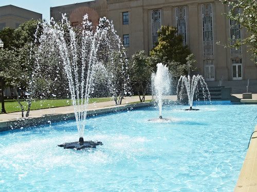
… a good omen for the meeting, I was thinking.
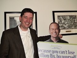 Here, I’ll try to present in an organized and coherent manner (my notes lack that quality — he allowed me to jump around and ask about stuff as it occurred to me to think of it) that Mayor Cornett’s Chief of Staff had to say.
By the way, David is the tall guy on the left. Click on the photo for a larger view.
First off, despite the biting criticisms I’d made in the original article of his boss, the Mayor, if not City Council, David was more than polite and gracious at all times during the meeting, and I was made to feel comfortable and welcome, even on those occasions that smart-ass questions or comments managed to pop out of my mouth. We exchanged many laughs and no frowns and I would say that the meeting was marked by a gregarious tone and was a wholly respectful time, both ways. Heck, at the end of the meeting, he even gave me an official Bic Grip Roller pen containing graphics of the city’s logo and the Mayor’s signature when I left as a souvenir of the meeting. How cool was that?

Second, and much more importantly, a summary of the the discussion follows — I’ve paraphrased our words unless otherwise stated. Don’t be fooled by the fairly organized structure presented below — a tape recording would show that the conversation was much more random and disorganized than is presented below, largely because of my own jumping around with various questions and comments.
- What about those town hall and/or other meetings in which additional citizen input might be received and considered in the formation of the final MAPS 3 package. Rightly or wrongly, some of us expected that such meetings would occur — why didn’t they?
David said that he was unaware that the mayor had ever mentioned “town hall meetings” and would be surprised if he did, since such types of meetings are not part of Mayor Cornett’s style. (Remember, I’m paraphrasing.) He did say that he would stand to be corrected if I found something to the contrary.
Yesterday morning, I looked to see what I could find. I found absolutely no press or other media reports which used that phrase, “town hall meeting” with regard to MAPS 3. So, I have to conclude that term was the product of my own wishful thinking and was an error on my part in the initial article.
But, in searching the Oklahoman’s archives, I did find that the eighth annual “Mayor’s Development Roundtable” was scheduled for and did occur at the Cox Convention Center on May 13, 2009. In his OkcCentral.com blog article called “End of Summer” on August 30, 2009, Steve Lackmeyer said,
OK, before anyone gets picky about it, I’ll concede that technically summer isn’t over until Sept. 21. But in terms of all the discussion that took place back in May, it seems as if we’ve only had a lot of behind-closed-door discussions and pronouncements by Mayor Mick Cornett as to what will and won’t be on the MAPS 3 ballot.
We’ve certainly not had any public forums or opportunities for residents to tell city leaders what they want to see on the ballot – a process Cornett indicated would take place over the summer before the ballot items were to be decided (Cornett indicated such a process would take place while being questioned at a press conference during the Mayor’s Development Roundtable in May).
So, despite my flop on “town hall meetings,” I didn’t come up completely empty handed in my research.
To my knowledge, no specific opportunities for public input as to the final MAPS 3 ballot occurred after the May 13, 2009, Roundtable meeting through the time of the September 17 press conference which officially announced the content of MAPS 3.
That’s so even though other Oklahoman articles indicate that at least some potential items, such as a June 8 article concerning the Bricktown Canal extension and, as well, a July 3 article was again mentioned as were possible locations of the convention center. In the latter July 3 article, the Mayor was quoted as saying (emphasis supplied),
“The MAPS 3 ballot is not a done deal, and this [the possible canal extension] could be considered,” Cornett said Thursday. “I’ve not had any level of depth of conversation with the council about plugging this in. But I think the idea of whether it’s a MAPS 3 project is very much on the table and I don’t think a conclusion has been made.”
On whose table? The table was a private one and was not public. The public did not participate in a discussion of the alternatives which were privately being considered.
Taking Mayor Cornett’s statement at face value, the final configuration of MAPS 3 was NOT a done deal as of July 3 even though it became one by the August 17 news conference. Location of the Convention Center was, may still be, an open topic. But there were no public meetings in which the item was discussed.
We know now that the potential inclusion of a Bricktown Canal extension did not make the final cut. Whether the size and configuration of the proposed Central Park was reconsidered we are left to guess, based upon an absence of reported information.
“Transparency” is a big deal with the city, and, presumably, that means that you and I actually get to “see” what is going on whether the “going on” be in a public or private meeting. However, the problem with non-public decision-making has nothing to do with transparency, it has to do with invisibility.
Private decision-making meetings certainly do not involve the participation or knowledge of the public where you or I give any input; they do not involve our knowledge, either, of what might have transpired. And, apparently, no record exists that such meetings and decisions ever occurred. Transparency means, I think, that one can see what is going/has gone on. Invisibility means that one does not know what is or may have gone on. There is a difference.
So, I think that I’ll just pass this one back to David and ask, “Were any public (citizen) meetings scheduled on any of these open topics; secondly, if only private meetings were held, why was that?” Surely, some explanation and decision as to why the possible Bricktown Canal extension was not “plugged in” is available; ditto for the convention center location, as mentioned above.
By e-mail, David’s October 5 response to the above is the following:
From the Mayor’s perspective, every day is one long public meeting. All he did for several months was talk about MAPS 3 with citizens. Our door was always open. And though I wouldn’t say we received a ton of e-mails on the topic of MAPS 3 during the period you mention, we are easy to e-mail, and all that we received were read by myself, the Mayor and the City Manager.
As to why the Canal extension wasn’t included, it probably falls in the category of good ideas that there just wasn’t enough room for. As for the Convention Center location, as I indicated in our meeting, that’s still an open question, and the time for a substantive public dialogue may not occur for several years.
Between the 2007 online survey, our open door policy, and the normal interaction with the public by the Mayor and Council, who are elected to represent the people of Oklahoma City in such conversations, we are confident there is not an opinion that wasn’t heard. Just because an opinion isn’t used doesn’t mean it wasn’t heard, and it’s also possible the time for a certain decision hasn’t actually arrived yet.
- How were decisions made about the non-core items made, where did the input come from? By “non-core” (my term, not David’s), I mean other than (a) the central park, (b) convention Center, and (c) street cars … items not having a downtown focus. To mimic the model used by Mayor Norick in original MAPS, something needed to be included for others in the city who are not so much only, or at all, interested in the development of downtown and the inner city (as big a priority as that is with me).
David’s response was that, largely, identification of the other items in MAPS 3 came from City Council members, e.g., a couple favored the senior citizen and wellness centers, and so on. About the development of the Oklahoma River item, he said that no one or two council members were responsible for that but it was more the result of a consensus that such projects be included.
- About the absence of detail, I asked if greater detail about the proposed projects wasn’t presently available in addition to what is described in the Summary. This one was kind of fun as we were both enjoying playing with each other — me with my disbelief, David in his obvious sincerity that the city didn’t have much if any greater detail for the most part beyond that contained in the Summary.
Why my disbelief? MAPS 3 IS NOT a Johnny-Come-Lately kind of thing — it’s been in various stages of planning for years — and but for a Ford Center opportunity which arose in December 2007 and was voted on March 7, 2008, we’d have almost certainly already voted on MAPS 3 by now if not at the exact time that the Ford Center vote occurred. But, the NBA gods and designated angels were with us in this twilight zone time in our city’s history. Regardless of the supernatural factors, by reason of the Mayor’s magnificent leadership in this time, the March 7 vote occurred with astonishing swiftness and surgical accuracy, it passed muster in the public’s vote, and during July we wound up getting an NBA team in a mind-boggling short span of time. Seattle fumbled. Either that, or as Bob Berry Sr. once said (and by doing so coined the phrase when talking about something entirely different), Seattle lost the team by reason of “self-tacklization” and offered Oklahoma City a mighty fine opportunity should this city opt to land on their fumble and run the ball in for a touchdown. Which we did.
But before that opportunity presented itself, and but for all of the late 2007-early 2008 developments regarding the NBA, some form or measure of MAPS 3 was in all probability ready to be put on the voters table by late 2007 or early 2008. So, when MAPS 3 was revisited in 2009, it was not a “new” deal. The Core To Shore final report was presented in late 2007. Although Core To Shore and MAPS 3 are not synonymous terms, at least some elements in MAPS 3 and Phase 1 of Core To Shore — central park, convention center, and streetcar — are essentially the same. So, surely, with all of that time to think about it, it is more than reasonable to think that more detail is available than that which has been presented so far.
David said that there are three levels of questions that voters ask vis a vis a MAPS type proposal, some being more concerned about one level than another: (1) The Generalists (my term) who say, “Do I want the city to continue to move forward with what began with the initial MAPS?”; (2) Those who focus on the identification of projects, generally, e.g., those who want a central park, those who want light rail, those who don’t, etc.; (3) Those who want to know still more detail about the projects, particularly (my words).
To make the point, using the March 4 Ford Center vote as an example, David threw it back to me, knowing that I had already identified myself as being a gung-ho March 4 Ford Center vote supporter. “Did you want to know about loge seating in the Ford Center?” “No, I didn’t — my interest was focused on getting an NBA team, my only concern,” I replied (or something like that). His point, of course, was that, for that vote, I didn’t care about detail.
He also said, when I inquired about street car routes, “Does it matter to you whether the route is on Hudson or Harvey?” I replied, “No, but I’d like to have an idea of what route is contemplated.” I said, “One graphic shows the street car going into Bricktown. Does that mean that it will? David’s response was basically, “Duh …” He didn’t put it that way but I got the point and I now take it that a that a Bricktown path is a certainty.
My take? Great … but what’s wrong with explicitly saying so in the MAPS 3 documents? We shouldn’t have to guess.
Anyway, no route is formally set, should that matter. I don’t suppose that it does, as long as it goes through Bricktown.
Hmmm … might he be make progress with me?
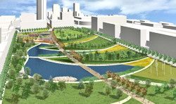
- What about the pictures — do the graphics presented by the city mean anything about detail or not? As an example, I asked him about the lake design shown in the proposed central park — should we presume that the lake will probably look like that … or not?
David began responding by getting into whether people might like the design, but I interrupted and said that wasn’t my question — the question being more general and having to do with how we, you and I, should interpret graphic images presented by the city. Does the detail in those graphics present detail that should be expected, at least kinda sorta, or not? In this instance, I asked him if we hadn’t paid someone (Hargreaves Associates, I think) more than $500,000 to come up with a park design, and wouldn’t one expect that the detail shown would most likely be reasonably reliable?
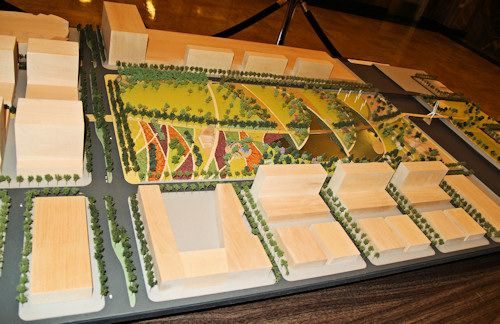
This is the model on display in the City Hall entrance …
… and it would be fair enough to suppose that we’d be getting more than a concept and a nice model to display for the $500+ thousand spent. Maybe that’s just me.I don’t recall what David said about this. I’m emailing him the link to this revised article and he’s at liberty to correct any impressions I have that are wrong, and I’ll make needed changes. I have no wish to mischaracterize anything that he said.
By e-mail, David adds the following on October 5:
I think it’s fair to expect implementation of what you see in the latest park designs. But that’s not to say that if some detail met with a public outcry, that the City wouldn’t respond and make an alteration. That’s all part of the ongoing public discussion that has traditionally followed every MAPS vote. Election day is really the beginning, not the end. But we have verified that the money set aside in MAPS 3 can create what you see in those designs, and I suppose we did that for a reason – we do understand that the designs create expectations. So I think you can rely to a great extent on those designs, understanding that there is always a natural adjustment when vision meets reality.
- Other Projects. About the State Fairgrounds, David said that a master plan is in place and that it would be fair enough (no pun intended) to expect that MAPS 3 money earmarked for the fair would be done to develop that plan. Ditto the master plan for trails. On these, I agree … fair enough. About the proposed sidewalks and their location, it came up but only in passing, and I don’t recall what was said and I have no notes about that. Frankly, the sidewalks project was not, is not, at all important to me but a better reporter would have taken greater care about this MAPS 3 element than I did to for the sake of being thorough.
- Has a location for the convention center been determined or is that still up for grabs? I mentioned my concern, and that of some others, that a location south of the Ford Center, as opposed to south of Lower Bricktown in the Cotton Producers Cooperative Oil Mill area which I understand to be up for sale, might be detrimental to Bricktown development.
About this, David was (as I recall) somewhat vague but he did say that, in the end, a cost analysis of acquisition of the comparative areas Cotton Producers Cooperative Oil Mill would have to become involved. I think that he said that, for the south-of-Ford Center, land acquisition costs would be around $30M (an OG&E power substation is located there) but the cost of the Coop Oil Mill area might be much greater. I think (but am not sure) that he said the $30M was included in the $280M projected cost. He can correct me about this if I’ve got it wrong.
If it’s so that $30 million is included as part of the convention center cost, that would seem to make south of the Ford Center the default location, even though David didn’t say that it was.
By October 5 e-mail, David adds:
Yes, the $30M for the OGE substation relocation is included in the convention center estimate, but that $30M mitigation budget could just as easily go towards mitigation at a different site, if that made sense at a later time.
- What about the Senior Citizen Health and Aquatic Centers? What might they be like and how many might there be?
David said that no decision had been made about this but that the Mayor liked what had been done in Little Rock and he mentioned the name, “Patrick Hayes.” After the meeting, I Googled for that combination of words and came up with this weblink in North Little Rock, Arkansas. Combining a pair of graphic images there, you get this:
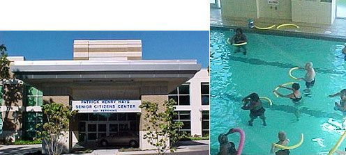
Now, if that presents the general notion of what MAPS 3 might involve, even if only as a concept, why not show that image just as I’ve done by web search?
Even if the North Little Rock facility is only presented as a concept, ain’t somethin’ better than nuttin? Seems so to me, but, once again, that’s just me — even if the question of “how many” remains an unknown.
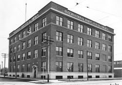
- What about historical preservation issues? Are all buildings in the path of Central Park gonners? I went to David’s computer and showed him new and old pics of the venerable 1909 International Harvester Building on S. Broadway, shown at the right. I don’t recall that I showed him pics of the Film Exchange Building on S. Robinson. I also asked him about this Journal Record article in which it was reported that properties a block or so off the Core To Shore Phase 1 perimeter were being acquired by the city, which could include the International Harvester Building on Broadway.
Whip me if you want, but the only thing that I recall that David said about historic preservation issues is that the city had run out of money to be used for acquiring new properties. I think, but do not specifically recall, that he said that such issues could be addressed as MAPS 3 develops down the line, should it pass on December 8. David can correct me if I’ve said this wrong.
- What about a timeline as to when this stuff will be constructed? Naturally enough, NOTHING can get started until some sales tax receipts are generated. But is there any sequence of when the various parts of MAPS 3 will be constructed?
David indicated that there was no timeline in place for beginning the 8 projects involved in MAPS 3 except that I think that he said that the downtown park would likely begin first, which is natural. But, officially, a timeline does not exist.
By an October 5 e-mail, David adds the following:
This is correct, but I would also add the Mayor has expressed a preference for the convention center to probably be staged last.
- About The Fuzzy Ballot. Although we discussed this topic at length, that discussion is reported in a companion article, MAPS 3, The Actual vote.
That’s as good an account of our conversation as I’ve got to give, except for this last important thing.
At one point in our discussion, perhaps when discussing ballot issues which are discussed here, I showed him a copy of the original MAPS ballot which, of course, itemized each of the original MAPS projects one at a time. Having a look at it, he said something like the following (not his words, but mine to capture the point that he was trying to make):
Wow. That’s a lot of detail, “A baseball park meeting not less than ‘AAA’ professional baseball standards’; ‘The improvement of the Myriad Convention Center and/or related facilities.'”
While those weren’t the exact words that he used, he was clearly using polite sarcasm to make his point: The level of detail that I’ve complained about not being presented in MAPS 3 wasn’t given in the original MAPS proposal, either. I think that it was then that a 15 watt oven-light-bulb turned on in my head — not a 150 watt dazzler but one which was nonetheless internally noticed.
As this revised article is being written, it has now been 7 days since the meeting with David Holt. When leaving, I told him that I would be thinking about what he had said. I have. As part of that process, I’ve also tried to put myself into my 1993 shoes when I checked the box in that ballot, “For the Proposition — Yes.”
Doing my own self-critique, I have today, October 4, reached five conclusions:
- I haven’t changed my mind about the absence of public input since this past spring; it should have been provided for but wasn’t.
- As to the sufficiency of detail, I have placed greater demands upon the MAPS 3 proposition, and Mayor Cornett, than I did with the original MAPS, and Mayor Norick.
- I have been wrong in doing so.
- Sufficient detail has been provided by the city to reach a voting decision.
- I can now remove the “
probably” in earlier statements I’ve made such as, “I willin all probabilitybe voting ‘Yes'” since on December 8 I will be checking the box, “For the Ordinance — YES.“
After the meeting, David sent an email (which he said that I could quote), as follows:
More detail is coming – maybe not as much as you had hoped, but it will be everything we have. And we believe that what we will ultimately present is the appropriate level of detail, based on previous MAPS customs and best practices. December 8 isn’t the end of the implementation and the public’s role in this process – it’s the beginning of what will be a decade of more detailed decisions that this community will have to make – funneled through the citizen oversight board and your elected officials. That’s how MAPS and MAPS for Kids worked, and we’re not trying to reinvent the wheel with MAPS 3.
Again, I thank David, and his boss who surely must have authorized this meeting, for a very pleasant conversation.
Although out of chronological sequence, I thought that the foregoing matters should be covered first. Now, jump back to September 17 to begin the sequence of events which began on that day, beginning with Mayor Cornett’s announcement.
THE ANNOUNCEMENT. Flanked by council members Gary Marrs (Ward 1), Pete White (Ward 4), Skip Kelley (Ward 7), Meg Salyer (Ward 6), and Sam Bowman (Ward 2), on September 17 Mayor Mick Cornett announced that the Maps 3 was ready and that it would be submitted to the City Council on September 22, less than a week later, and would presumably be voted upon on by the council September 29, a week after that. Additionally, letters of support for 2 council members not present were in hand from Larry McAtee (Ward 3) and Patrick Ryan (Ward 8). Only J. Brian Walters (Ward 5) was unaccounted for and who has since announced his opposition.
The Oklahoman’s video of the press conference appears below. It begins after the point that the mayor greeted those in attendance and council members present were identified, as well as two others who could not be present but had issued letters of support, mentioned above. About a minute is lost in the Oklahoman’s video and it doesn’t present the graphics which were being shown as the mayor was speaking but it was all I could locate which could be embedded here. A complete video, but one which I was unable to embed, is at the Channel 9 website, should you want to see the whole thing.
An area of the city’s website, www.okc.gov/maps3 popped up the new information on the same day. There, part of the text reads,
The initiative proposes a diverse list of eight projects:
- A new, approximately 70-acre central park linking the core of downtown with the Oklahoma River
- A new rail-based streetcar system, plus potential funding for other rail transit initiatives, such as commuter lines and a transit hub
- A new downtown convention center
- Sidewalks to be placed on major streets and near facilities used by the public throughout the City
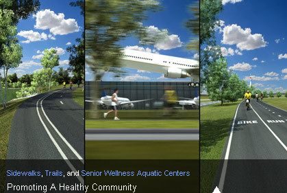
- 57 miles of new public bicycling and walking trails throughout the City
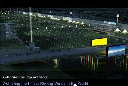
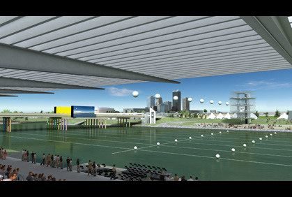
- Improvements to the Oklahoma River, including a public whitewater kayaking facility and upgrades intended to achieve the finest rowing racecourse in the world
- State-of-the-art health and wellness aquatic centers throughout the City designed for senior citizens
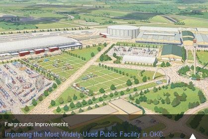
- Improvements to the Oklahoma State Fairgrounds
“This proposal dreams big, and it continues the momentum and renaissance of the last 15 years,” said Mayor Cornett. “I believe it will achieve the goals that have always defined MAPS projects – creating jobs and improving our quality of life. I think it recognizes the needs of the world-class city we are becoming, and I think it will capture our imaginations. If this initiative moves forward, the next 10 years of this City’s history will be more exciting than the last 10. We have hardly scratched the surface of what this City is capable.”
The MAPS 3 proposal calls for a seven-year, nine-month one-cent sales tax that will maintain the Oklahoma City sales tax rate where it currently stands. Oklahoma City’s sales tax rate is one of the lowest of all municipalities in central Oklahoma. If approved, the collection of the sales tax will commence on April 1, 2010, the day after the conclusion of the sports facilities sales tax collection that voters approved in March, 2008. The MAPS for Kids sales tax collection lasted seven years.
The estimated total cost of the initiative is $777 million. That total cost includes $17 million in contingency funds.
The creation of previous MAPS packages were inclusive for their time, created through committees or by elected City leaders, but technology allowed this initiative to be molded by the people of Oklahoma City through the most inclusive process to date. In 2007, Mayor Cornett announced the launch of www.MAPS3.org, which for four months conducted a “call for ideas” open to all citizens.
MAPS 3 SUMMARY. The www.MAPS3.org website presents a summary of MAPS 3. My summary of the summary is as follows:
- The Park. About 70 acres in a 2 block-wide swath from present I-40 to the new I-40, and then a 1-block area south to the Oklahoma River. The summary doesn’t say, but the east/west boundaries are presumably the same as those contained in the Core To Shore Steering Committee’s late 2007 final report, Robinson to Hudson on the north and Robinson to Harvey on the south. Estimated cost: $130 million
- Transit. 5-6 miles of downtown rail street car and perhaps (the summary is vague) intermodal transit hub (somewhere) in downtown. The summary does not specify the route. Estimated cost: $130 million.
- Convention Center. Aside from stating a rationale as to why the convention center is included, no details are stated, including location. Estimated cost: $280 million.
- Sidewalks. The summary states that,
This project will strategically construct sidewalks in different areas of the city on major streets and near facilities used by the public (such as schools and libraries).
The summary does not say where. Estimated cost: $10 million.
- Trails. The summary says, “This project will construct 57 new miles of bicycling and walking trails, all but completing Oklahoma City’s trails master plan.” Presumably, one could look up that plan and find the locations. Estimated cost: $40 million.
- The Oklahoma River. The summary reads,
This project will provide improvements to the Oklahoma River, including a public whitewater kayaking facility, and upgrades intended to achieve the finest rowing racecourse in the world. The whitewater facility is estimated to cost $25 million with the remaining $35 million to fund River improvements. Those improvements include grandstands, parking, Lincoln Bridge enhancements, a floating stage, river beautification, lighting and other improvements to the course itself.
What irony! Not so long ago, we had a river which was said to be the only river in the country which had to be mowed twice a year, and now the city is an internationally (and US Olympic-ally) recognized rowing venue. Estimated cost: $60 million.
- Health & Wellness Aquatic Centers for Senior Citizens. Hey, I finally get a pool! “Multiple” (count ’em) centers will be constructed at locations “around the city.” Estimated cost: $50 million.
- State Fairgrounds. The summary reads,
This project will upgrade publicly-used facilities at the Oklahoma State Fairgrounds, especially those used by the public during the annual State Fair of Oklahoma. It will consolidate various structures that are in excess of 50 years old.
The summary does not identify any particulars. Estimated cost: $60 million.
About these items, each voter must form his/her own opinions, about projects individually and as a package deal. My own, largely important only to me, are shown below.
| MAPS 3 ITEMS | Millions | High Priority |
Medium Priority |
Low Priority |
||
| 1 | Central Park | $130 | $130 | |||
| 2 | Modern Streetcars | 130 | 130 | |||
| 3 | Convention Center | 280 | 280 | |||
| 4 | Sidewalks | 10 | $10 | |||
| 5 | Trails | 40 | 40 | |||
| 6 | Oklahoma River | 60 | 60 | |||
| 7 | Senior Health Centers | 50 | $50 | |||
| 8 | Fairgrounds | 60 | 50 | |||
| 9 | Contingency Fund | 17 | 17 | |||
| Totals | $777 | $617 | $100 | $50 |
RESOURCES TO HELP YOU THINK. While I’ve now arrived at my own decision, many of you have not and you may want something else to read. You’ll get the city’s side of things from its own MAPS 3 pages and from that of the Greater OKC Chamber, which is handling the MAPS 3 campaign, at this location.
But, for additional objective analysis (i.e., other than Doug Dawgz Blog), where might one look for stuff to read?
- The Oklahoman. Objective reporting? Unlikely. Get real — who is the present Chairman of the Board of the Chamber (I generally like the Chamber and think it has done a lot of good for the city, just so that you’ll know)? David Thompson. Who is heading up the Chamber’s MAPS 3 campaign? David Thompson. See this video and Oklahoman article. Who is president of the OPUBCO Communications Group? David Thompson. When the Oklahoman publishes an article which objectively analyzes MAPS 3, such as those mentioned by the Oklahoma Gazette below, I’ll be more than willing to acknowledge the error of my ways.
- The Oklahoma Gazette. Objective reporting? Likely. This weekly publication has demonstrated a willingness to explore both sides of MAPS 3 issues. For example, as to the city’s need for a new convention center, click here, and, unlike the Chamber which declined to release its own MAPS 3 polls, the Gazette and News 9 engaged Shapard Research to conduct a scientific poll, the results were fully released and published in the Gazette. As well, the Gazette recently published this article in which Mayor Cornett and others explained what is needed to be done between now and December 8.
- The Journal Record. Objective reporting? Unknown. Although the Journal Record has an area set aside for Core To Shore, it has not yet done so for MAPS 3. As of this writing, the Journal Record hasn’t reported much (if anything) about MAPS 3, though surely it will. One would suppose that editor Ted Streuli’s blog, Hot Topic would eventually pick up and start discussing MAPS 3, but so far, MAPS 3 is a missing person there.
Of course, one expects to see and hear stories on the local radio and television media, but unless sound bites will help you reach a decision, not much in depth analysis should be expected there. Last time I checked, Oklahoma City does not have a local equivalent of the likes of NBC’s Meet The Press or CBS’s Sixty Minutes.
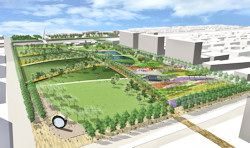
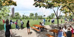
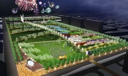
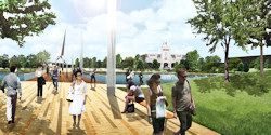
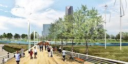
PARK PICS. I’ve extracted the 8 images in the PDF file showing views of Central Park. The extracted images are quite large (5400 px wide) so I’ve shrunk the kids for internet purposes. Click on any thumbnail below for a 1024 px wide rendering.
at the Maps 3 Website
OTHER IMAGES. The “YES for MAPS coalition” opened its campaign yesterday by providing at least a peek at a few graphics representing some of the items — the Chamber is leading the effort so I presume that it set up the coalition’s website. Still not much detail is provided, but it’s a start assuming that it is fair to draw reasonable inferences from the images. The website is http://www.yesformaps.com
I’ve done a screen capture of the images we’ve not seen before (I’ve not included the night-time fireworks shot over Central Park which we’ve already seen). Larger images are not presently available:
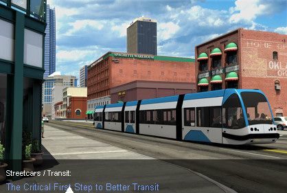
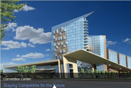
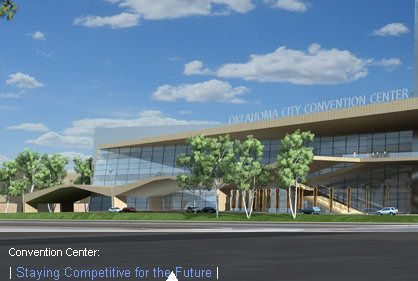
When additional renderings of elements of Maps 3’s proposal, I’ll add them here.

