Click here to go to Part 2 – Floods & Change
Click here to go to Part 3 – MAPS & Change
Click here to go to Part 4A – Facilities & Activities
Click here to go to Part 4B – Oklahoma River Trails Tour
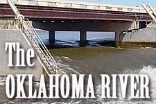
Ahh … the “Oklahoma River”! Of this, our ancestors knew nothing at all since it didn’t exist before 2004… they only knew of the “North Canadian River”! Click the map for a closer look.
From Wikipedia:
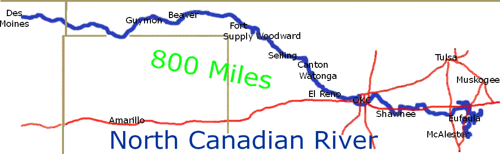
North Canadian River is a river that flows through New Mexico, Texas and Oklahoma in the United States. The North Canadian River rises just east of Des Moines, New Mexico in Union County, New Mexico. From there it flows eastwardly through the Oklahoma Panhandle, where it is known as the Beaver River. It flows southeastward into the Texas Panhandle into Sherman County, Texas for six miles, turning northeast and back into the Oklahoma Panhandle before continuing on to the east. It enters Northwest Oklahoma and turns southeast and takes the name North Canadian River where it is joined by Wolf Creek just south of the town of Fort Supply, Oklahoma. It is dammed at Canton, Oklahoma in Blaine County where it forms Canton Lake. It flows past Oklahoma City, Oklahoma 708 km, joining the Canadian River.
A seven-mile portion of the river flowing through Oklahoma City was renamed the Oklahoma River in 2004.
According to Oklahoma City’s website:
A 7-mile stretch of the North Canadian River has been transformed into a series of river lakes bordered by landscaped areas, trails and recreational facilities and known as The Oklahoma River.
Dams at Eastern, Western and May Avenues raise the level of the river. Locks at Western and May Avenues will allow boats to navigate the entire 7 mile length of the river project.
That link also describes various public uses and regulations (e.g., fishing, boating) so go there if you want to know more about that. Well, since it may be important to many of you, I’ll note this one regulation: “Noodling is prohibited in the Oklahoma River but is allowed from the NW 10 Bridge downstream to the MacArthur bridge.” So, be warned!
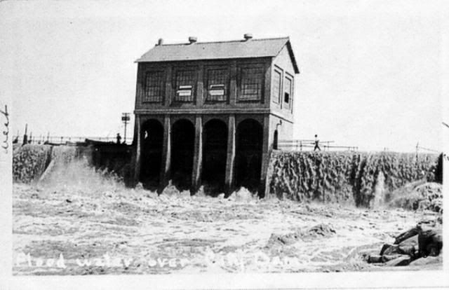
In the Delmar Garden and Wheeler Park post, we’ve already seen some postcards showing fanciful images of the North Canadian. The river was cool on good days, but ruthless on bad.
Were the pretty postcards real? Who can say, but chances are these 1889 photos give a more realistic picture. Left, somewhere near downtown; Right, the 1st bridge (Robinson) crossing the river. Click on pics for larger images.
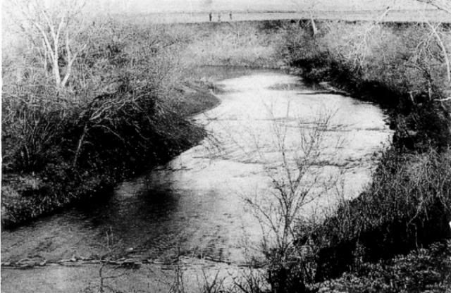
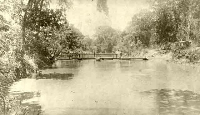
Left: from Mark Klett, Photographing Oklahoma 1889-1991 (Oklahoma City Art Museum 1991)
These are real, too …

From Vanished Spendor II , Edwards and Ottaway (Abalache Book Shop Pub Co 1983)
People must have gotten tired of the beauty in favor of safety after awhile, so the river’s sharp meandering got straightened out and moved to the south. But, it surely wasn’t pretty anymore … what’s the joke about this being the only river in the country that had to be mowed twice a year? Here’s a pretty ugly pic from 1991 … I’ll try to find out if the river was being drained for improvements … but, apparently, it may also have been the only river that you could watch TV underwater … well, if there was any!
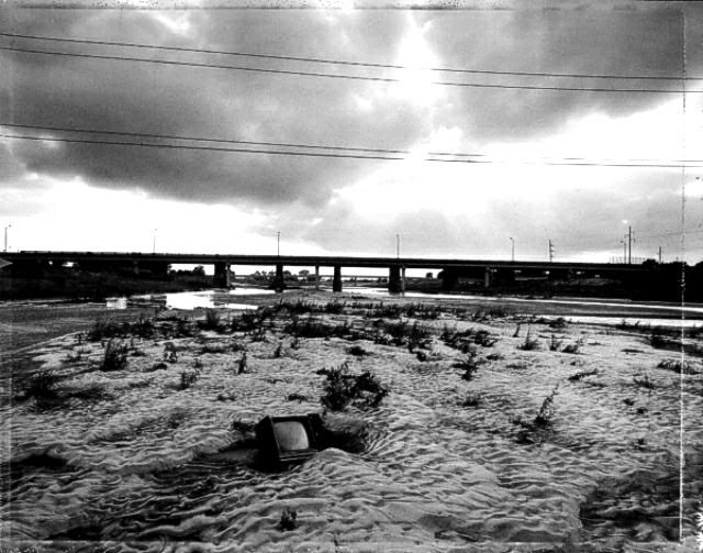
Mark Klett, Photographing Oklahoma 1889-1991 (Oklahoma City Art Museum 1991)
The posts in this series tell something about how the river stopped looking like the above to become and ever more become like like those below:

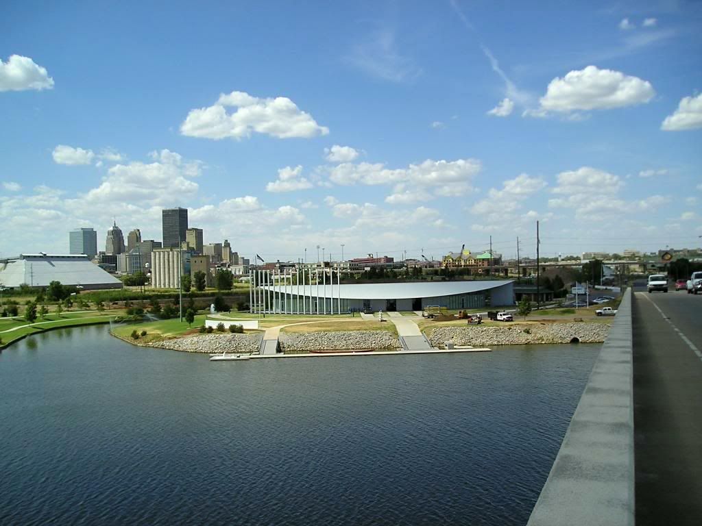
Taken by me on 8/10/06
Enjoy!